


A Wisconsin Eye Test (Unframed)
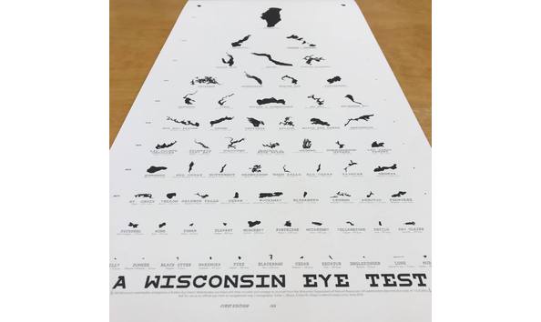
A subset of Wisconsin's lakes mapped at a uniform scale, but arranged in the form of a Snellen Eye Chart. The scale selected for this poster (1:525,000) allows these waterbodies to approximate the dimensions of characters on a standard eye chart. This chart arranges some of the state's most iconic lakes in a way that calls viewers to get to know Wisconsin's aquatic resources. Along with detailed footprints of 66 of Wisconsin's waterbodies, this poster also includes lake names, sizes, and location data for those who want to have a closer look. Intended as a tongue-and-cheek test of Wisconsin's hydrography, it encourages readers to recall what these lakes look like on conventional maps. Take a step back and test your lake knowledge!
Note: Item will be shipped directly to winning bidder.
Donated by :Company Name : Colterrific Maps!